Dubai Metro Blue Line: Full Route, Station List & Updated Map 2025
Published :
Last Updated :
Published :
Last Updated :
Dubai is a city that already has a world-class public transport system, but even that is being increased, with the most key infrastructure project in the city set to change the way residents get to move across the city, the future Dubai Metro Blue Line. The metro will introduce a new line on 9 September 2029 with its peculiar Y-shaped orientation and 14 modern stations that will connect the major residential, business, and university areas.
With Dubai gearing towards a more affordable and sustainable future, the Blue Line should alleviate traffic, CO2 emissions, and help in achieving the vision of the smart city movement within the city. This blog describes the Blue Line route, stations, a map of the Dubai Metro, and how the Dubai Metro is likely to change the landscape of Dubai.
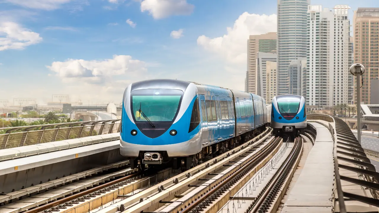
Dubai Metro Blue Line is a highly ambitious improvement of the transport system in the emirate. The sovereign HH Sheikh Mohammed bin Rashid Al Maktoum, nodded on this 30-kilometer line in November 2023, with the objective to transport more than 320,000 passengers daily, in 2040. The project is the key point of the 2040 Urban Master Plan that is supposed to render Dubai more interconnected, sustainable, and welcoming to commuters.
The blue line has a distinct Y format in its design with two branches. One of them starts out at Creek Station in the Green Line; the other one at Centrepoint Station in the Red Line. The two cross at International City 1 Station and extend further to Academic City, which is the Eastern terminal of the line.
The metro line includes:
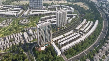
It will also expand the metro coverage of Dubai by 30 kilometers, adding 14 stations to the present 64 stations. The growth is crucial in facilitating expanding markets such as Silicon Oasis, Academic City, Industry, and commercial hubs such as Dubai Festival City.
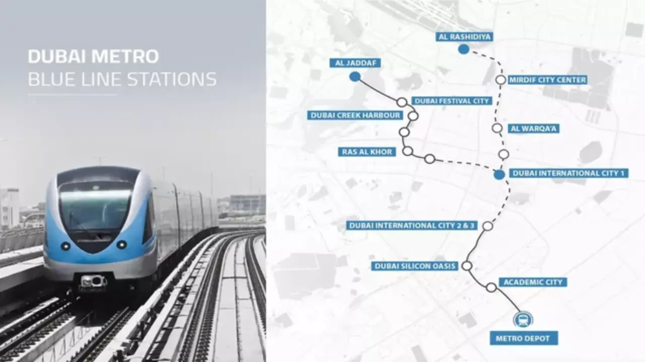
The route line of the Dubai Metro blue line is in the form of a Y, and this is very convenient, thus making it very efficient. It covers two arms:
All these routes have been strategically selected because they will not only improve coverage to underserved places but also connect the key centres of education, retail, and employment.
The design of the Dubai Metro Blue line will accommodate the existing transport network, comprising feeder buses, bicycle lanes, and walking streets. The RTA has disclosed that the new line will feature park and ride structures, last-mile transport (e-scooters, etc.), and contemporary passenger services at every station.
You can view the Dubai Metro Blue Line map and updates on the official RTA website.
All the Dubai Metro Blue Line stations have been strategically located along population density, future development potential, and intermodal connectivity. And this is how it works:
Creek is currently a station of the Green Line, but the station is projected to be the key hotspot between the Green and Blue lines. It is near the Al Jaddaf Marine Transport Station, which allows integration of ferries and the metro.
It is a station located close to Dubai Festival City Mall that serves retail traffic, local hotels, and the Al Badia community.
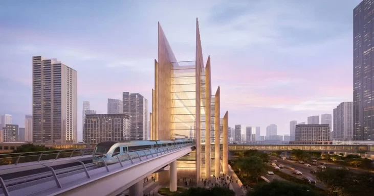
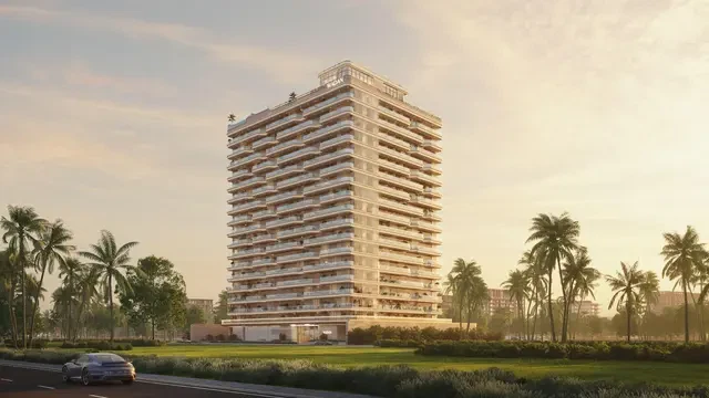
The superstructure is going to be the tallest metro with 74 meters. Skidmore, Owings & Merrill (SOM) is the designer, and it will be used as the anchor of the Emaar-developed mega project called the Creek Harbour.
This station will cater to the industrial zone, besides facilitating new residential developments in the zone.
This will be one of the busiest stations in the line because it will serve as a Y-junction. It connects International City phases as well as Blue Line arms.
Located in International City and serving sub-clusters, those stations serve thousands of residents and workers in their daily commutes.
A significant halt of the community of innovative areas of DSO that comprises schools, gated communities, and tech parks.
This is the end-of-the-line up the Creek arm, and it serves more than 60,000 students and staff working in its environs.
An interchange station with the Red Line, connecting the metro riders with Rashidiya, Dubai Airport, and the centre of Dubai.
Residential station near the Mirdif City Centre mall, and a number of schools, was developed as a way to reduce congestion and provide a direct line to the metro.
Serves a family neighborhood that houses schools, community centers, and parks.
The new stations will possess up-to-date facilities such as Wi-Fi connections, smart ticketing, commercial kiosks, and weather-controlled waiting rooms. Notably, they will all be disability friendly and based on the principle of universal design of Dubai.
The Metro Blue Line completion date is one of the most anticipated things about this mega project. The Dubai Metro Blue Line will start its construction in June 2025 and will commence its operation on 9 September 2029. This is not a random date as it falls in the 20th anniversary of the opening of the first Dubai metro back in 2009.
Timeline Milestones:
It will be managed by the RTA of Dubai along with international engineers, consultants, and contractors. The strategy of the RTA takes into account sustainability and limited disturbance during its construction.
Dubai Metro Blue Line is likely to cause far-reaching impacts on the economy and on routine life. The Blue Line is expected to promote the reduction of carbon emissions and traffic jams because it will have more than 320,000 daily users by 2040, leading to the replacement of many people using their cars.
Key benefits include:
The project would also contribute to the Dubai Clean Energy Strategy 2050 since an electric-powered mass-transit system would have a lesser impact (carbon footprint) as opposed to the conventional means of transportation.
By 2030, the RTA says that more than 55% of the inhabitants of Dubai will have access to a metro or bus station within 800 meters. The blue line is also influential in that milestone.
Dubai Metro Blue Line is one of the groundbreaking infrastructural projects in Dubai, not only enhancing the performance of public transport but at the same time boosting the sustainability, innovation, and inclusivity of the city. It links important areas like the Festival City, Silicon Oasis, and Academic City, which also increases connectivity and economic potential.
The future of urban mobility in Dubai is not only smart but also sustainable because it has 14 well-planned Dubai Metro Blue Line stations, with a defined Blue Line map, and a confirmed end date, September 9, 2029. With the city being more expansive, the Blue Line is ensuring that no community has been left behind.


Your gateway to offline planning in the digital realm. Discover a world of real estate opportunities through our immersive offline property website experience
Apartments
AED 560,000
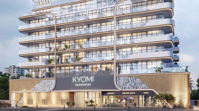
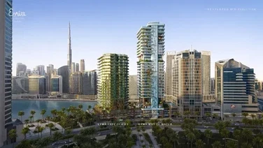
Dubai International City
Studio, 1 & 2
385 - 1362 Sq Ft
Commercial
AED Price on Request
Motor City
Apartments
Studios
AED 599,000
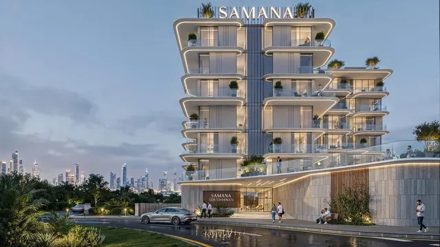
Dubai South
Studio, 1 & 2
Apartments
Penthouses
AED 3,900,000
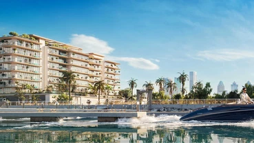
Dubai Islands
2, 3 & 4
1017 - 7008 Sq Ft
Apartments
Studios
AED 650,000
Dubai Land Residence Complex
Studio, 1 & 2
420 - 1600 Sq Ft
Apartments
AED Price on Request
Jebel Ali
1, 2 & 3
1124 - 2490 Sq Ft
Apartments
AED 560,000
Dubai International City
Studio, 1 & 2
385 - 1362 Sq Ft
Apartments
Studios
AED 599,000
Dubai South
Studio, 1 & 2
Apartments
Penthouses
AED 3,900,000
Dubai Islands
2, 3 & 4
1017 - 7008 Sq Ft
Apartments
Studios
AED 650,000
Dubai Land Residence Complex
Studio, 1 & 2
420 - 1600 Sq Ft
Apartments
AED Price on Request
Jebel Ali
1, 2 & 3
1124 - 2490 Sq Ft
Apartments
Duplexes
AED 1,670,000
Dubai Islands
1, 2 & 3
848 - 2607 Sq Ft
Commercial
AED Price on Request
Motor City

Commercial
AED Price on Request
Damac Lagoons

Apartments
Commercial
Penthouses
AED 2,000,000
Meydan
1, 2 & 3
640 - 4244
Apartments
Commercial
AED 1,900,000
Sheikh Zayed Road
1, 2 & 3
Apartments
Commercial
AED 1,142,000
Damac hills
1 & 2
740 - 6588 Sq Ft
Commercial
AED Price on Request
Mohammed bin Rashid City
Apartments
Duplexes
AED 1,670,000
Dubai Islands
1, 2 & 3
848 - 2607 Sq Ft
Apartments
Duplexes
AED 679,000
Jumeirah Village Circle
Studio, 1 & 2
388 - 2159 Sq Ft
Apartments
Duplexes
AED 2,661,000
Dubai Islands
1, 2, 3, 4 & 4
60 - 9121 Sq Ft
Apartments
Penthouses
Duplexes
AED 9,000,000
Business Bay
2, 3, 4 & 5
2154 - 22900 Sq Ft
Apartments
Studios
Duplexes
AED 830,000
Dubailand
Studio, 1, 2 & 3
420 - 3800 Sq Ft
Apartments
Penthouses
Duplexes
AED 2,390,000
Dubai Islands
1, 2, 3 & 4
757 - 5826 Sq Ft
Apartments
Penthouses
Mansions
AED Price on Request
Palm Jumeirah
1, 2, 3, 4, 5 & 6
1541 - 12382 Sq Ft
Villas
Mansions
AED 20,000,000
Mohammed bin Rashid City
5 & 6
13,007 - 13,568 Sq Ft
Apartments
Penthouses
Mansions
AED 5,500,000
Palm Jumeirah
1, 2, 3, 4, 5 & 6
940 - 11830 Sq Ft
Mansions
AED 65,000,000
Jumeirah
7
41550 - 49062 Sq Ft
Mansions
AED Price on Request
Tilal Al Ghaf
6 & 7
Mansions
AED Price on Request
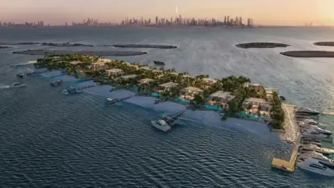
Damac Islands
Apartments
Penthouses
AED 3,900,000
Dubai Islands
2, 3 & 4
1017 - 7008 Sq Ft
Apartments
Penthouses
AED Price on Request
Jumeirah Garden City
Studio, 1 & 2
1026 - 2255 Sq Ft
Apartments
Penthouses
Duplexes
AED 9,000,000
Business Bay
2, 3, 4 & 5
2154 - 22900 Sq Ft
Apartments
Penthouses
Duplexes
AED 2,390,000
Dubai Islands
1, 2, 3 & 4
757 - 5826 Sq Ft
Apartments
Penthouses
AED 26,000,000
Business Bay
3, 4 & 5
6684 - 43059 Sq Ft
Apartments
Penthouses
AED Price on Request
Rashid Yachts and Marina
1, 2, 3, 4
729 - 2974 Sq Ft
Apartments
Studios
AED 599,000
Dubai South
Studio, 1 & 2
Apartments
Studios
AED 650,000
Dubai Land Residence Complex
Studio, 1 & 2
420 - 1600 Sq Ft
Apartments
Studios
AED Price on Request
Dubai Investments Park
Studio, 1 & 2
390 - 2421 Sq Ft

Apartments
Studios
AED 666,000
Sheikh Zayed Road
Studio, 1, 2 & 3
Apartments
Studios
AED 790,000
Jumeirah Village Circle
Studio, 1 & 2
400 - 1310 Sq Ft
Apartments
Studios
AED 649,000
Sheikh Zayed Road
Studio, 1, 2 & 3
380 - 1400 Sq Ft
Townhouses
AED Price on Request
Dubai Investments Park
2, 3 & 4
Townhouses
AED Price on Request
Dubai South
Townhouses
AED Price on Request
Dubai South
Townhouses
AED 4,750,000
Dubai South
4 & 5
3801 - 4915 Sq Ft
Apartments
Townhouses
AED Price on Request
Emaar South
1, 2 & 3
791 - 2778 Sq Ft
Townhouses
AED Price on Request
The Valley
Villas
AED 4,900,000
Jebel Ali
4 & 5
2966 - 8231 Sq Ft
Villas
AED Price on Request
Mohammed bin Rashid City
5 & 6
Villas
AED Price on Request
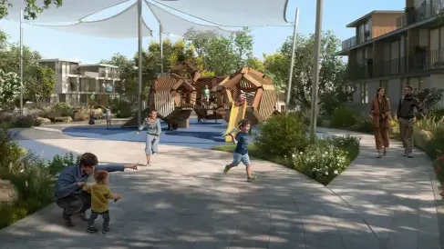
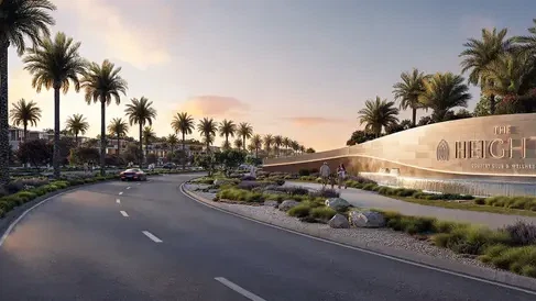
The Heights Country Club & Wellness

Villas
AED Price on Request
The Heights Country Club & Wellness
Villas
AED 4,000,000
Sobha Sanctuary
4 & 5
2459 - 3430 Sq Ft
Villas
AED 4,000,000
Sobha Sanctuary
4 & 5
2520 - 4154 Sq Ft
Subscribe to our Daily, Weekly and Monthly Newsletters, Expert Advice and Latest Launch with Zero Spam, Unsubscribe Anytime.